RTK Topographic Surveys & Site Models

High-quality RTK-enabled drone surveys delivering topo plans, terrain models and site records for civil engineering projects. We capture ground levels and key site features and tie outputs to your site control / local grid using established survey control and QA checkpoints to produce clean topographic plans, existing ground surfaces for design use and pre-construction studies.
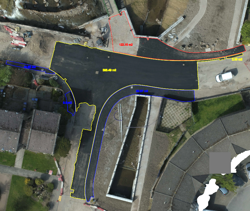
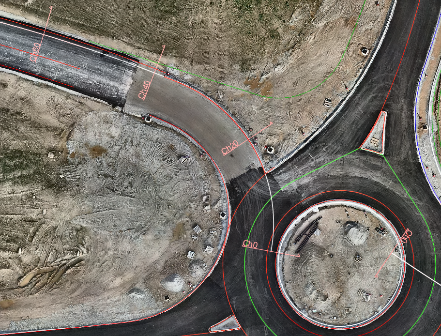
Deliverables: 2D CAD topographic drawings, 3D terrain models, contour maps and GeoTIFF orthomosaics aligned to your site grid and project coordinate system.
✔ Pre-construction topographic surveys for highways, wind farms and energy projects
✔ Existing ground models for design, planning and value engineering
✔ Preliminary drainage and level checks in sensitive areas (flood risk, SuDS, attenuation ponds)
✔ Baseline topo and reference models for later earthworks, as-built records and O&M manuals
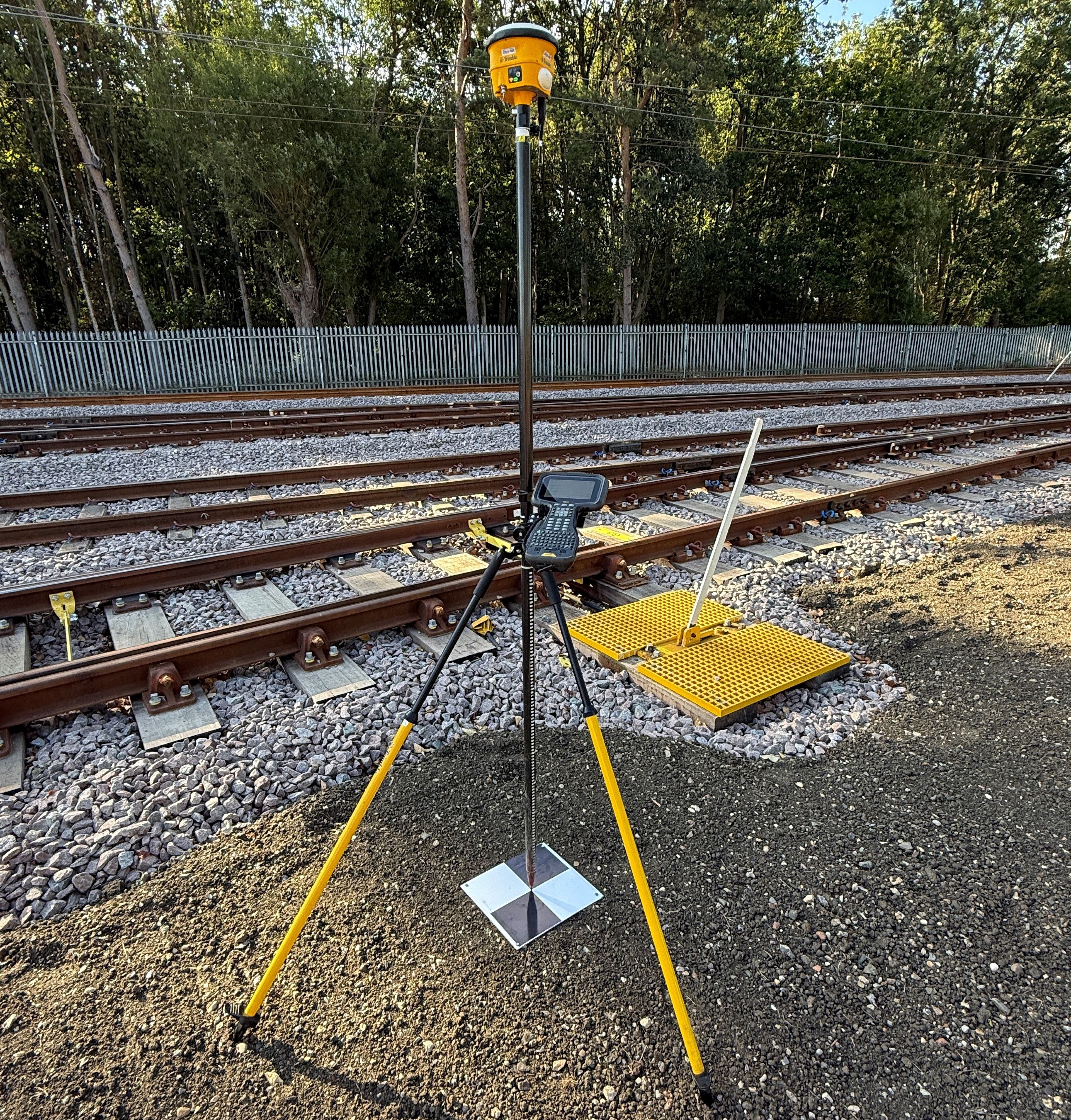
✔ RTK-referenced ground levels and breaklines derived from the survey data, tied to your site grid
✔ Hard features – kerbs, channels, fence lines, manholes, headwalls, walls, drainage features
✔ Soft features – ditches, embankments, tree lines, watercourses and vegetation boundaries
✔ Site control points and benchmarks tied to your local grid and permanent markers
✔ Main contractors and civil engineers delivering highways, earthworks and infrastructure
✔ Survey teams who need rapid site capture to support setting out, QA and reporting
✔ Designers and consultants requiring reliable topo data and CAD-ready terrain models
✔ Developers and asset owners who need accurate site records for planning, design and handover
✔ Utilities and rail contractors working in complex corridors where access is restricted or time-critical