Quarry Production Monitoring

Problem:
The quarry required accurate monitoring ofmaterial extraction, stockpile volumes and crusher output. Traditional methodswere time-consuming, limited in coverage and not providing up-to-date data tosupport production decisions.
Blasting operations and ongoing extraction made it difficult to maintain consistent control over material movement and site changes.
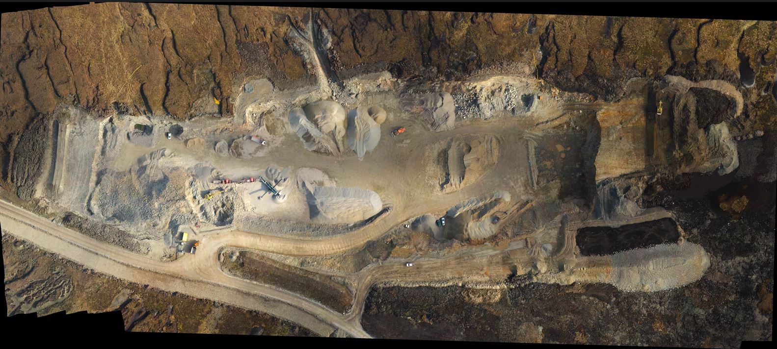
High-resolution quarry orthomosaic

Terrain model used for volume analysis
Results:
• Accurate tracking of extracted material volumes
• Improved control over stockpiles and crusher output
• Clear visibility of changes after blasting operations
• Ongoing verification of material quantities using rapid volume calculations
• Full site coverage in a single survey
• Faster and more confident production decisions
Engineering Value:
The data was used for:
• Production tracking
• Stockpile control
• Material verification
• Post-blast terrain analysis
• Rapid volume calculations
Deliverables compatible with Civil 3D and engineering workflows for direct operational use.
BACK